Tutorial 9
As you have probably noticed throughout these tutorials, some of our maps have looked rather distorted, flat, or stretched. As the Earth is round there are numerous ways to depict the globe in a way that would satisfy the map users. Each ‘way’ is called a Coordinate Reference System (CRS). Let’s have a look at the different types of projections that are available.
WGS84: THE STANDARD CHOICE
The projection CRS we have used in all our tutorials is WGS84. It is the standard CRS for world maps. It works extremely well and is based on latitudes and longitudes, which is particularly useful when you wish to georeference maps for instance.

However, most parts of the globe which are not located near the Equator (e.g. Europe, North America) end up being severely distorted.
THE RIGHT CRS FOR THE RIGHT PLACE
Naturally, you will quickly understand that there is a perfect CRS for each place you are focusing on. If you are working on a global map, you should probably keep WGS84. If not, here’s a list of what you should use.
- Europe: ETRS89
- Britain: OSGB 1936 / British National Grid
- North America: North America Lambert Conformal Conic (there will be more specific ones if you are focusing on a particular state or province).
- Google Maps-like world map: Google Mercator (EPSG:3857 or EPSG900913).
HOW TO MANAGE DIFFERENT CRSs
Very naturally, one problem could quickly emerge: you might have different layers that are all working under a different CRS. There is one easy way to make sure they are all compatible: in the toolbar, click on Project then on Project Properties.
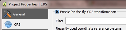
A new window then opens. You must select the CRS tab, then tick the Enable ‘on the fly’ CRS transformation box. You will then need to select the CRS that will serve your map best, and click on OK.
TIP: If you wish to work efficiently with latitudes and longitudes, we would recommend to prepare your whole work in WGS84 before switching to a more accurate CRS when you finalise your project. Some CRSs do not function according to a latitude/longitude scale and therefore it could be difficult to carry on your work. For instance, if you are georeferencing a map of Britain, we recommend that you do all your work under WGS84 then enable the On The Fly mode to OSGB 1936 before exporting your map.
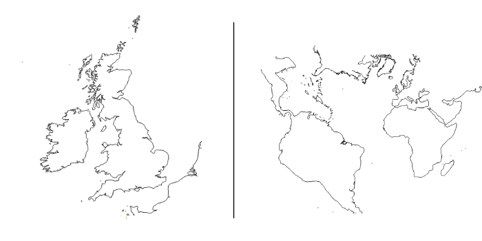
KEEP IN MIND: Some CRSs will prevent you from using any other part of the world but the one you are interested in. The below example with the OSGB 1936 CRS is very good as it shows that any piece of land significantly far away from the British Isles will be completely distorted.
Last update: 4 May 2015 on QGIS 2.8.1 Wien.